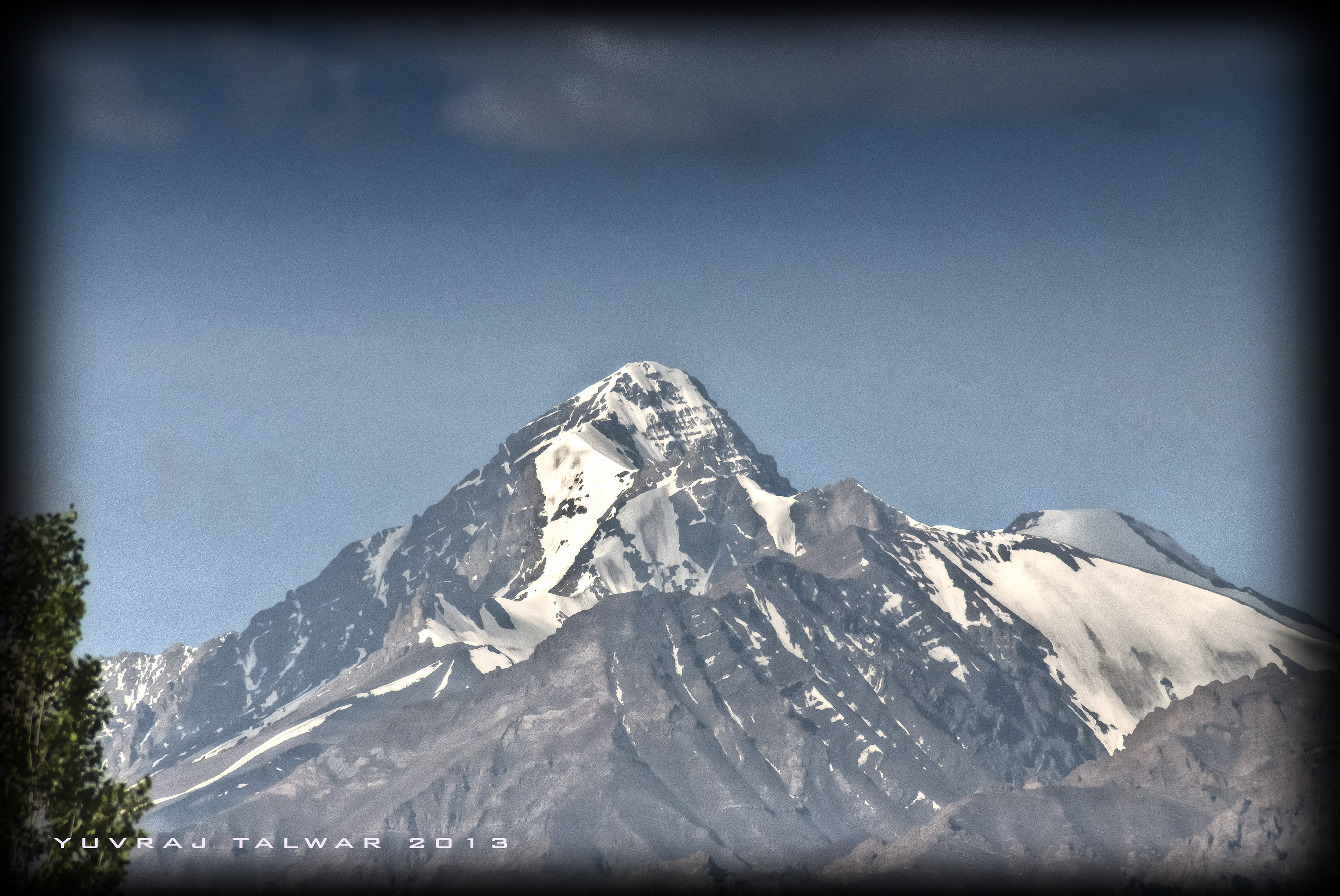
Stok Kangri, Ladakh (6153 m) Indian Himalayas
The Ladakh Himalayas are unique in the Indian landscape. The lush green hills that you are used to seeing in photos, along with deep river valleys and massive peaks give way to a treeless, grass-less granite mountain with basalt roots. The reason for this mountain desert is due to its location on the Himalayan rain-shadow. The monsoons have given up their moisture content by the time they reach this part of the Indus Valley. Being perpetually dry throughout the year has not lulled its appeal to avid adventure-sports enthusiasts, who throng the capital town of Leh for extensive recreational activities.

The magical beauty of the arid Himalayas.
So why Ladakh?
Well, as I was sitting in a remote part of Uttarakhand, during the month of August, staring out the window at the rain falling continuously for 2 weeks, thinking how sunny and dry Cherrapunji would be as compared to this, I yearned for some outdoor activity. After a brief research I found that the only treks available this time of the year were in Ladakh.
And there lies the feather in its cap for trekkers. It’s in bloom when there is no other place in India left to trek.
The mountains being quite high in Ladakh (Leh itself is 11,500 feet) I thought I might break the 6000 meter barrier with a trek here. Stok Kangri is nearly 20,182 feet, considerably higher than the 14 steps I’m used to climbing every day. So I announced this at lunch at home. After the laughter stopped and the food cleaned off the floor, the plans were made.
When you arrive at Leh airport, the first thing you notice is the heaviness in breathing. It’s like you have asthma. The key to overcoming this is to acclimatize. So no activity for at least two days. Just short walks to admire the incredible blue skies, the barren landscape, the strong sun and bone-dry air. The rest of the time I was sitting in my room staring outside the window thinking how rainy and humid Uttarakhand would be as compared to this. Some people call me fickle but I don’t think I am. Or maybe I am. Or maybe not. Anywhoo.

Ladakh. A study in contrasts – the lush green Indus valley below and the barren hills above.
The day before the climb Tsewang, our guide, took our measurements for the snow boots. We hired them as they’re expensive to purchase. The thin fleece outerwear we carried he advised against – if it’s windy (constantly is) the fleece allows body heat to escape. Crampon sizes were measured (stop sniggering at the back, I said crampon, not tampon), and we were good to go. To sleep.
We went by car to Zingchen, where our bags were loaded onto the mules and we carried our rucksacks onwards. The trail till the village of Rumbak was a gradual slope with few places that required crossing the river. This involved taking your shoes off and finding the right spot from which to cross. As usual, with my luck, I crossed at the point where the stream was as least a foot higher for me than for anyone else. The current is deceptively strong. And freezing. The good thing is that within 10 seconds you can’t feel your extremities. By that I mean your toes. You just put your foot down where you see no sharp rocks, and pray that you don’t slip and slide all the way to Pakistan. Because, if captured, I doubt the Indian government will pay even a stray dog for my exchange.
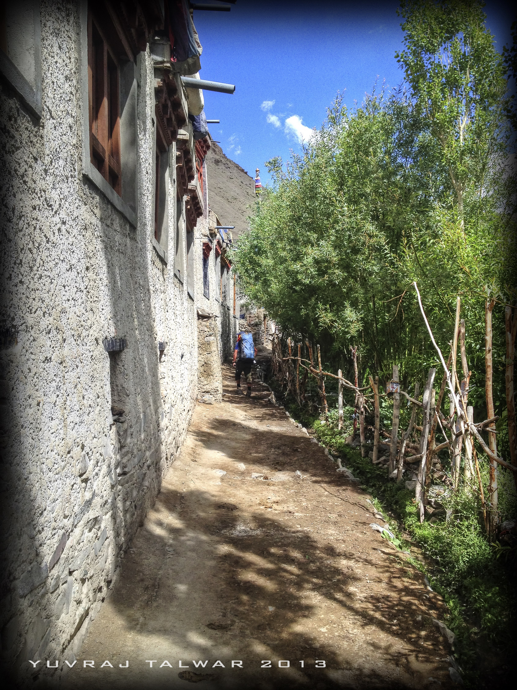
The village of Rumbak itself is a peaceful hamlet of stone houses, with tiny windows typical of an arid climate, which reduces glare and retains heat. Thick stone walls also absorb heat during the day and radiate it inside through the night. In the winters, this village is famous for snow leopard sightings. We pitch tents a little way off the village, in an area used only for campers, with a tiny stream flowing through.
Rumbak village. One of the best places for Snow Leopard sightings in winters. Ok, maybe not on this path. But higher up on the mountains.
It’s amazing to see how the entire village economy is geared towards tourism, as these three months are the main source of income for most of the inhabitants. There are stalls offering tea and snacks, all solar heated. Proper bins for wastes are kept outside – in this terrain a plastic wrapper on the mountainside stands out like a Saint Bernard in a cat show. These sustainable measures really warm the heart of architects like me, who have spent a lifetime incorporating them in designs for houses in more urban areas where their use is intensely required. And failing miserably to convince even the more educated owners. And here, these simple people care more about their tiny piece of hillside than most people do of their entire city. Many of these house offer night stays to trekkers, with food included. It’s a great chance to experience the day-to-day living of the hill-folk in Ladakh.

As the sun falls below the peaks and the sunset creeps prematurely, I notice small brown tufts closing in towards the kitchen tents. When Tsewang informs me that they mouse hares, I set up the tripod, and as with all wildlife photography, hold perfectly still for 20 minutes or so to let them get accustomed to my presence. When I was close enough, I snapped off a couple of shots. Due to the barren terrain, every hare is visible on the mountainside.
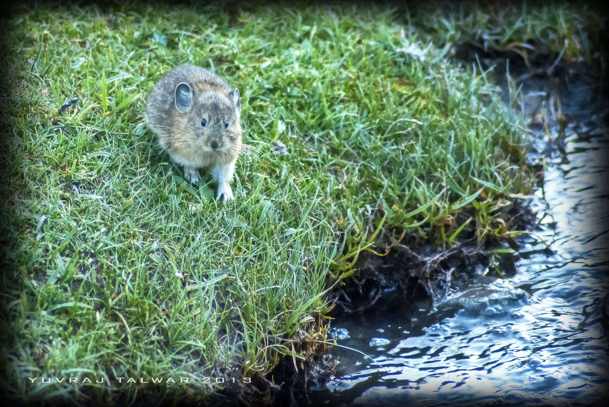
A Mouse hare. Is it a mouse? Is it a Hare? Is that really grass?
The next day we have to climb the Stok La, the highest pass on this trek. It gets steeper the higher you go. The typical 100-steps-and-stop routine goes down to 40 steps. Near the top of the pass it’s more like 13 steps between breaks. And then you see the usual prayer flags across the pass, before you know it you’re standing at the ridge looking down through the crystal clear air at the expanse of the Himalayas below. The lack of vegetation means that distances are very difficult to determine – the effect of perspective which helps in range-finding give way to a super-sharp image, where you can see across the mountains without any drop in visibility due to haze. Everything is pin-sharp. Even the blue-sheep dotted across miles of hillside.

Blue Sheep. Yes, exactly like smurfs.
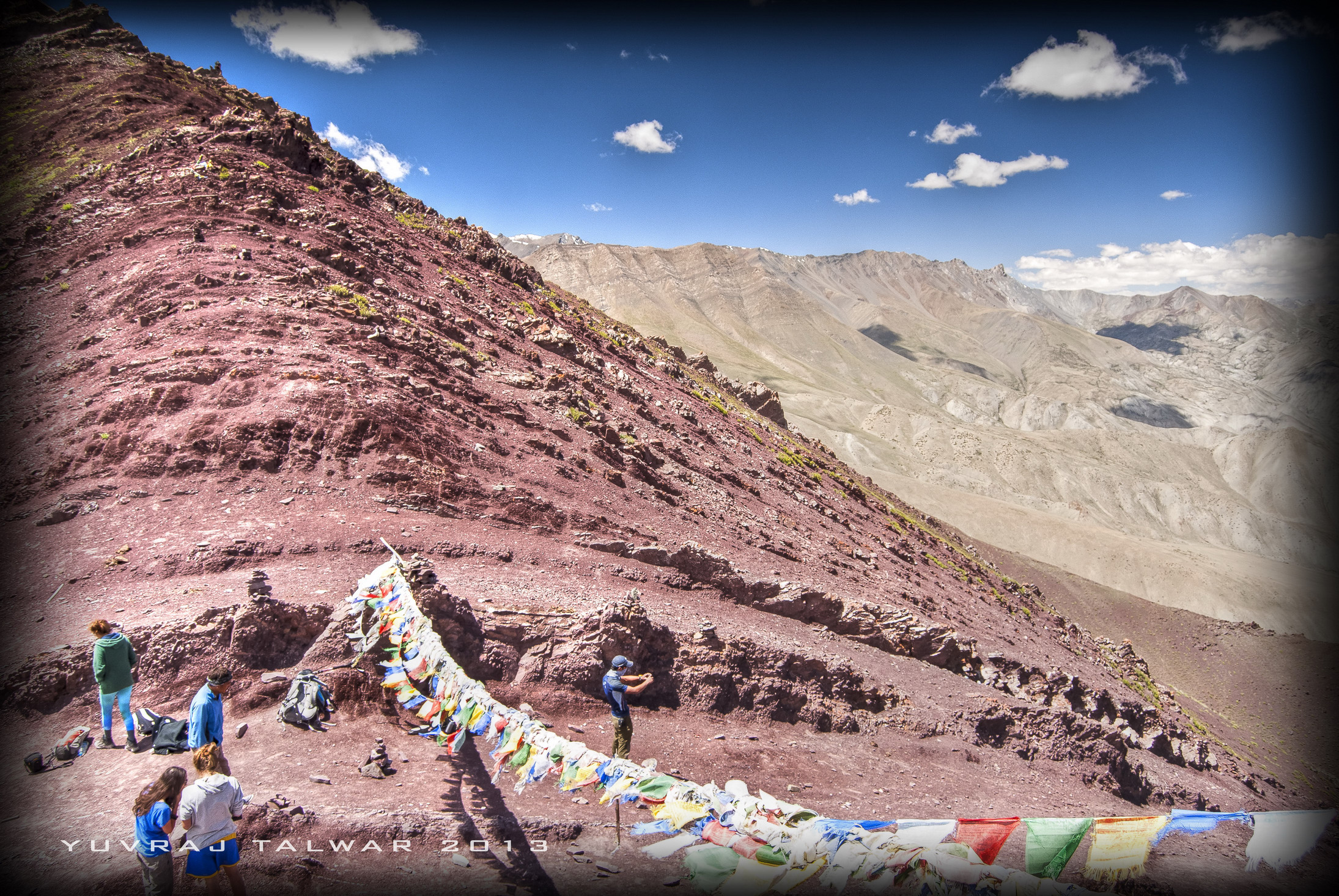
Stok La pass.
The descent from the pass is more difficult than the climb up. The rocky, almost volcanic soil, can easily dislodge, and with the sheer climb down, you might end up reaching Mankarmo (the next camp) earlier than you would like – sliding toboggan on your backpack. So dig in those heels and use the trekking pole between steps.
The next day from Mankarmo is a gradual slope to the base camp, which is in a valley at the base of the range which you’ll climb later on.

The Base-camp. Nice and dry. For now.
The rest stop here is two days, to acclimatize to the altitude – you are now at roughly 18500 feet, and the air is even thinner. Surprisingly, here you’ll find a small shop for equipment rentals, food, tent hire, and even beer. The last one may look tempting after three days of hectic climbing, but the dehydration effects of alcohol can be severe at this height and climate. So I walk past looking longingly at the bottles lined up outside, knowing that at this temperature they will be nice and chilled. Sigh.
When we wake up the next day, we realize that it snowed at night and, unlike rain, the snow made no sound during the night. This, ironically, was unlike my partner in the tent, who gave all the trumpeting sounds he had within him at night, making the entire base-camp sound like a Sri Lankan elephant safari. So here’s what the base camp looked like in the morning.

Base-camp the next day. We went for an acclimatizing walk. Can you see me? I’m next to the white patch on the hill behind
A general lazy day today with a little climb to the top of the opposite mountain to keep the muscles in tune. Couple of phone calls (yes, there is a weak signal at the very edge of the camp), and lots of stories from the people coming down, having just attempted the peak.
Dinner is at 5.00 pm and we’re off to bed at 6.00 in the evening. 12.00 am at night is the wake up call, (but the trumpeting in my tent only stopped at 12.15) and by 1.00 am, in the dead of the night, we are out.
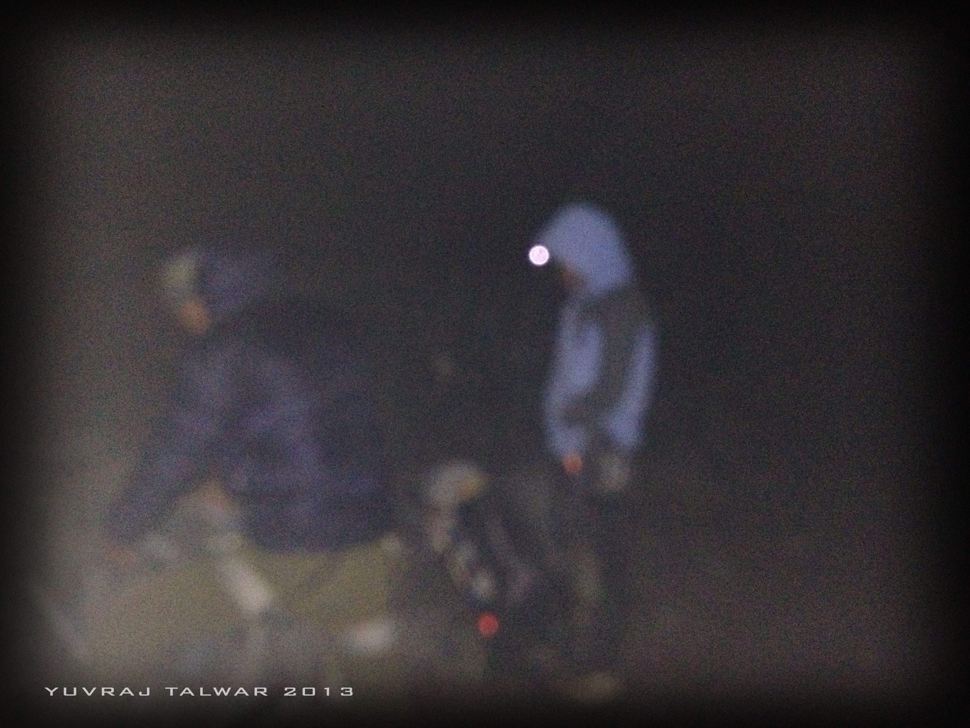
Yes, i know, very sharp image. Its 1.30 in the freaking AM!
With the lucky streak that I’ve been blessed with since childhood, after 10 days of clear weather, today of all days it’s overcast, windy and snowing. The heavy snow boots with crampons feel like lead flippers, the headlamp is useless in the driving snow, and the trail gets more and more invisible. The brown stony path that you are used to in these hills gets completely faded to white, so you have to be more careful where you step, risking a slide down the steep slope. Remember Pakistan.
As soon as you reach the glacier the snow covered track turns to glassy ice, and here is where the crampons and snow boots save your life every step of the way. You can step where you want, the grip will not budge an inch. After two hours of traversing the glacier, sidestepping small crevices which only our guide could see, the path turns up towards an almost vertical wall of a mountain covered in loose stones.

Who keeps sending me these damn whatsapp images? And why does Tsewang keep complaining about his numb-bum?
Four steps up and I’m stumped. The steel jaws of the crampons, which cover the bottom of your boots and which dig into the ice with their teeth, are totally without grip on loose rock. Taking them off would make the going smoother with just the boots. But Tsewang tells me that the glacier starts again in half a mile, so the crampons will be needed again. And after that there are two more hills with rocky slopes like these, so the crampons need to be removed again. On top of all this the snowfall is increasing, and the chances of the sun lighting up the hillside (so we can remove our headlamps and actually see where we are going) is not happening – the next 5 hours are going to be overcast and as dark as night. Removing crampons takes at least 15 minutes, what with removing your inner fleece lining, outer snow gloves, unzipping backpacks, tying crampons, etc. All the while in sub-zero temperatures, howling wind, near zero visibility and a crevice-prone terrain. Aaaaaaarg!!!!
I should have stayed at home staring out the window at the rain. ATLEAST IT CANT KILL ME!!
Even with the woolen parka covering my face, Tsewang could make out what I was mouthing. So we tie lifelines to each other’s carabiners and slowly inch up the slope. It’s all slip and go. When I glance at the time, the yelp that comes out of my mouth stops everyone. It’s 8.00 am – I was supposed to be taking photographs of the entire trek! When I take out the camera, everyone starts looking around – up, down left, right.
Take a photo of what? It’s like freaking midnight here!
After quickly removing the long list of clothing items, I managed to take some very nice pics. Low light shlow light, I’m clicking.
So, if you will……

Here is a beautiful sunrise over the Himalayas that every other trekker saw the past few days. Except us of course
Here is the starting of the glacier with the sun glowing in the background

Here i am with Hugh Hefner who is offering me the keys to the Playboy Mansion

Here I am hugging Paris Hilton, who was really impressed with my rugged looks, and offered me a role in her next “video”
Right, moving on.
The skies slowly start turning from coal-black to light-grey and the jagged saddle back of Stok Kangri is now visible. The glacier is smoother now, and I head up before anyone else to be the first one on the ridge which leads to the peak. Before Tsewang has a chance to stop me, I’m past him and standing at the spine of the ridge, determined to take a photos showing both sides of the mountain. It was only for two seconds.
The fierce wind coming up from the windward side knocked me straight off my feet like an uppercut, and I soared throughout the air landing on my Berghaus six feet away and buried half deep in snow, with the air sucked from my lungs.
As I lay there, looking up at the grey sky, and calling myself names which I really can’t print here, two heads poke into my field of vision. The eyes blinking for a few seconds, and the a familiar voice asking –
“For someone who is so loved by Paris Hilton, you are really smart”.
(Ok, I made that up!) Here’s what he actually said –
“For someone who claims to be smart, you disguise it very well.”
I croaked weakly “Lic….licen….!”
“What?!”
“License, get the license number of that truck!”
Amused, Tsewang slowly started picking me up and said “I can’t, he’s halfway to Leh by now, and my pencil is at the base camp.”
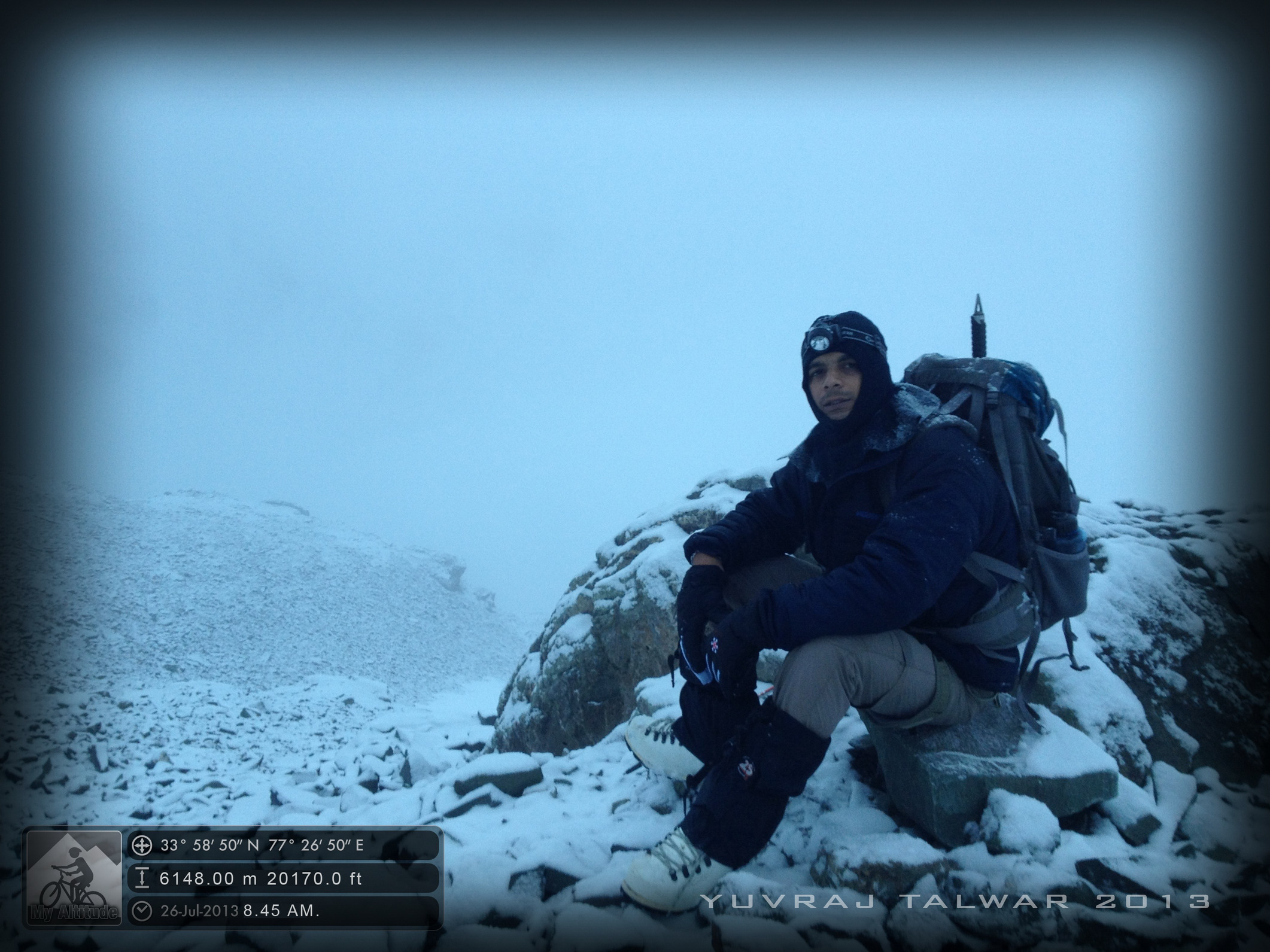
My rebuttals notwithstanding, we then started walking parallel along the ridge on the leeward side. One hour it took to cross the saddle back and reach the summit. The last hill is the steepest, and every three steps you need to stop to rest. The low oxygen level makes the going slow. Only after gritting your teeth and pushing every part of your body towards that peaceful-looking peak, do you reach.
Even with the haze, the magic that is 20,000 odd feet is hard to describe.
You are, literally, on top of the world. (Of this particular world at least.) To stand straight up on a peak in the Himalayas, having no mountain around which is higher than your eye level, looking down at everything, gives you a feeling of superiority which is hard to get over. Everywhere it’s downhill. Everywhere it’s white. The town of Leh is just a speck on the hillside. The wind here, of course, is fierce. My goggles are all fogged up and collars are filled with snow.

70 meters to the summit, i thought we’ll practice our poses.
But what shocks your system is the air – almost non-existent! Its thinner than Thumpy The Thumbnail who had nothin to wear. Regaining your breadth takes about 5 minutes rather than the 30 odd seconds at lower altitudes. Talking is pretty much avoidable; it’s an effort which you’ll have to recover from. The words come in spasms with a lot of huffing. After a minute of standing still, you realize that the cold is creeping through. As the body stops metabolic activity, the muscles get stiff faster. So we are warned not to stand around for long and to keep moving. It’s really weird to find yourself running out of rock, there is nothing left to climb. I wanted to just sit for a while, the waves of sleeplessness coming over me. I realized later on that this was very dangerous – it’s actually hypothermia creeping in and the body wants you to shut down. Tsewang noticed this and immediately gave me some (cold) coffee to boost my adrenaline. After my eyes widened a bit, I took out the camera.
Just below the summit. They said that you can see all the way to Delhi from here. Yeah, right.
There is not really any time to take photos. Just step below the summit and a couple of shots later we are going down again.
I won’t bore you much with the rest of the way down. The hormonal rush that stays in your system makes to unable to absorb any detail except that incredible view. I barely remember anything after that, and anyway, it seemed of no consequence. Three hours to base camp. Twice losing our way on the glacier – the fresh snowfall had covered our previous tracks. Thrice slipping despite the lifeline. Reaching in the late afternoon. Finally opening the bottle of beer that I was eyeballing. Sleeping for 10 hours straight – we had been climbing for a good 14 hours. And what I wanted most – the first hot water bath I had in 7 days, when I reached Leh.
But the details are all fuzzy, like the foggy mirror after a two hour steam bath.
All that remains in my mind, what I took with me to the monsoon back home, was that for about 5 minutes of my life, only a handful of god’s granite and basalt creations stood between me and his ultimate achievement – that piece of overgrown frozen rock, the mount they call Everest.

Miles to go before i sleep………….And before i find a single tree up here.

what a remarkable trek…and so well written…now it seems even i was with you all the way taking this trek with you..many thanx and congratulations…jai
LikeLike
Very well written Yuvraj! Makes me want to head to the mountains too.
LikeLike
Thanks. Try this then…https://wp.me/p58sJY-3W
LikeLike