On the edge of the Kumaon side of the state of Uttarakhand in India, isolated from the rest of the country by a continuous mountain range, and accessible only through a 10,000 feet pass crossed by a treacherously narrow road, lies a small settlement which is the Indian equivalent of a remote alpine village.
Perched at about 7500 feet, on the border between Tibet and India, the village of Munsiyari once represented the close relationship that Tibet and India shared before the Indo-China war in 1962. Between them they traded salt, utensils, wood and pashmina wool. The little town is actually about 15 kms as the crow flies from the Panchachuli range (24,500 feet) and about 25 kms from Tibet. Milam village, which the army took over during the war, is further down the mountainside, and is now more famous for the Milam glacier trek which ends at Munsiyari.
The route from Delhi can be either through Tanakapur and Pithoragarh, or the longer (but more picturesque) one through Rudrapur, Almora, Bageshwar and Chaukori. I would recommend the latter route which may require 2 night stays, but the advantage is that you’ll reach Munsiyari much before lunch time on the third day. The road from Chaukori to Munsiyari is narrow and difficult (even without the help of the suicidal jeeps carrying passengers) and should not be attempted in the evening light. The highlight of the journey is the 10,300 feet Kalamuni pass which requires a cautious approach while navigating through slush ice and boulder-strewn corners. A cup of tea is a must at the top of the ridge, if only to admire the fabulous vista through the fierce wind.
Munsiyari itself is a typical Himalayan village, with narrow streets, a central taxi stop and old bhootiya men with faces weathered after a lifetime spent under a high-altitude sun, smoking chilams while sitting on stoops in front of their houses. Herds of sheep pass roads on a regular basis, and the rhododendron trees which, at lower altitude have red flowers, are all studded with fuscia pink or white.
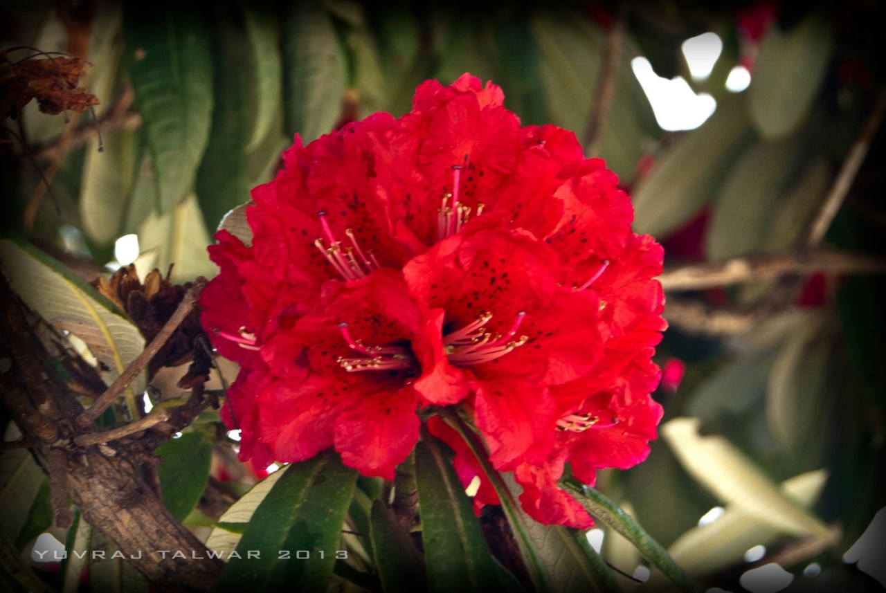
Rhododendron at lower altitudes

Rhododendrons in Munsiyari – the high altitude changes them to lighter shades
When you reach however, all of this is secondary to the pale shock you get when you see the Panchachuli (five peaks) range towering above you for the first time. It’s like looking up at a Jaeger from Pacific Rim. Or staring straight up at a 100 storey building. Or the way my two-year old must be feeling when I’m standing above her while she’s busy deleting all my iCloud data. This magnificent range looms high over you everywhere you roam. The distance being close enough, you can sometimes see small rock slides and avalanches appearing on the face of this 24,000 odd feet mountain. On a clear day, even the plume of snow which blows above the ridges can be seen. If ever there was a time to feel small and insignificant (besides sex I mean) this is it.
The Wayfarer Retreat, where we were staying, is bang in front of the range and a little out of town. Throughout the day every activity that you do – breakfast, lunch, evening walks, picnics etc, you are acutely aware of those five peaks following you around. Even at night in the moonlight, they glow while everything else is dark.
Munsiyari being the end off the line here, there isn’t much to do in town, but there are some local places nearby.
Birthi Falls is a waterfall on route to Munsiyari from Thal. It’s a small climb to the top and you can get to the bottom edge of the falls. It’s a nice spot to take a break and have lunch on the way to Munsiyari.
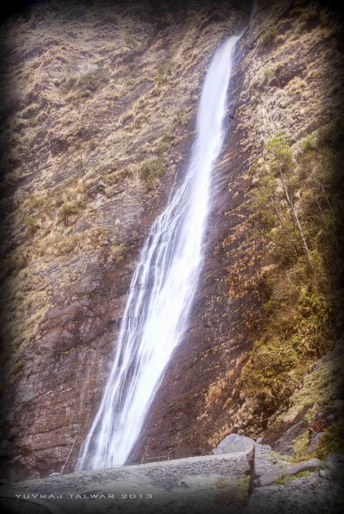
Birthi Falls
The other must-visit place is the village of Darkot, a little way down the hill. Famous for its residents, who are all weavers with generations behind them, all making pashmina shawls and angora stoles (among other items), this little village has maintained this traditional craft.

The village of Darkot. The residents spend the long winters weaving Pashmina and Angora shawls, stoles, blankets etc.
The raw wool is traded with Tibet in place of salt and utensils, and during the long winter months the women folk sit at their looms and painstakingly weave the shawls. It takes somewhere between 2 weeks and one month to complete ONE shawl.

Angora Rabbits
The Angora rabbits, which provide the wool, are also raised here and sheared. To buy, it’s better to go their co-operative shop in Munsiyari town where all the products are displayed, rather than trying to haggle here. You won’t win with them.
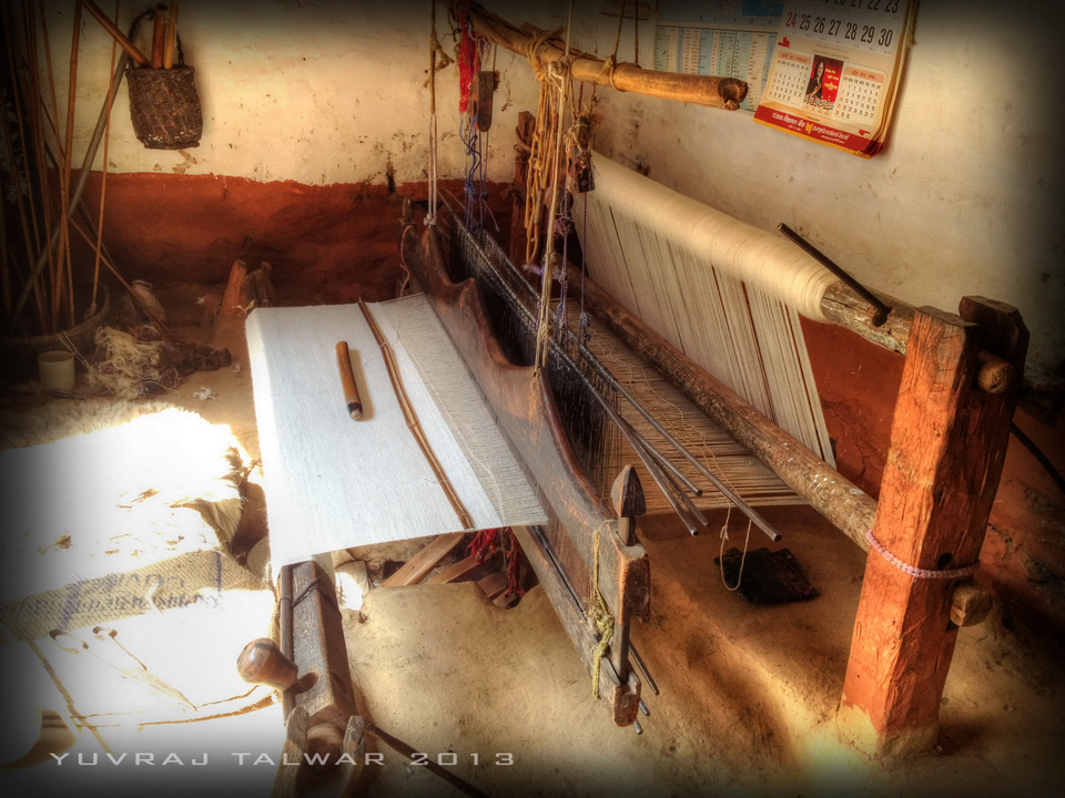
Pashmina Loom at Darkot
The plateau of Munsiyari Bugyal, which is about 6 kms from the lower part of town, forms a giant viewing platform, from which you can see the entire valley and the peaks above. It’s a great way to spend the evening hours before the sky gets dark.
Wayfarer’s retreat is also just near Masterji’s museum. Dr S.S Pangti has created a museum of antiquities and historically significant objects which tell the story of the region and the bhootiya history. Right from the early trading days with Tibet, to the types of utensils used, even a working loom showing how pashmina is made. Wooden stoves, the effects of the indo-china war and the part played by the locals. It’s a fascinating tour of one of the most remote regions of India.

Masterji’s Musuem
For the more physically inclined, a nice trek in the area is Khuliya Top, a little way from the main town. The trek starts at a place called the Balati Bend, and with a good packed breakfast you can reach in about 2 ½ hours. I climbed in March and the snow line started in about 30 minutes. If you are going anytime after April you should see snow only when you reach the KMVN guest house. The trek itself is simple enough with a well marked track, but a guide will be very valuable. Any of the hotels can provide you with one.

View from Khuliya Top (11,500 feet)
You can, if you want, do the trek in shorter time. But the stupendous views don’t allow you to walk more than 10 minutes without stopping and gaping (or in my case, lugging the entire camera equipment out and taking photos). From the top, a clear view is afforded of Hardeol, RajRambha, NandaDevi and NandKot Peaks. The sheer proximity to these, arguably, the highest mountains in the world, let’s you see them in their entire splendor. Every crevice, every ridge is visible, and on a clear day they blend into the Nepal Himalayas seamlessly. Once you reach the top, snow permitting, breathing might be a little difficult due to the altitude (you are nearly at 11,500 feet). A quick breakfast and you can be down well in time for lunch.
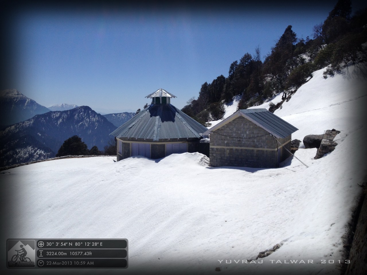
KMVN Guest House on route to Khuliya Top
The rest of the days can easily be filled out with just sitting out and gazing at the unparalleled views, going for short walks (they’ll have to be short as the altitude here might make you feel breathless) and a few lunch picnics thrown in. This place encourages a laid back approach. It’s one of the few towns in the Indian Himalayas that are close to the Tibetan border yet peaceful and tranquil. Facing away from India and towards permanently snow-capped peaks, you sit within a bowl of almost 7000 meter jagged rocks.
Out of the many hill-towns you’ll visit in your life, I’ll guarantee that this will be the one which will make you feel that Mother Earth always keeps her best very close to her heart. And away from prying eyes.


Leave a comment